

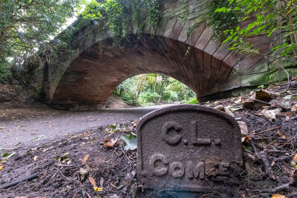
During construction of the new Garston Way bypass (A561) back in the early 1980’s. An old culvert was discovered on ‘Church Road’. The discovery was made where the new Garston Way bypass bridge was being built. The culvert is thought to have been one of Liverpool’s ancient rivers, the old Garston Brook. The original stone arch can be clearly seen here in these images.
Newspaper article reporting the discovery of the old Garston River Culvert, from the Liverpool Echo, Thursday 4th November 1982. Curtesy of The British Newspaper Archive.

These photographs were originally taken with my Ricoh XR7, on 35mm negative film. In order to be able to photograph the culvert before it would be lost once again, it was necessary to photograph over the top of the barrier surrounding the worksite.
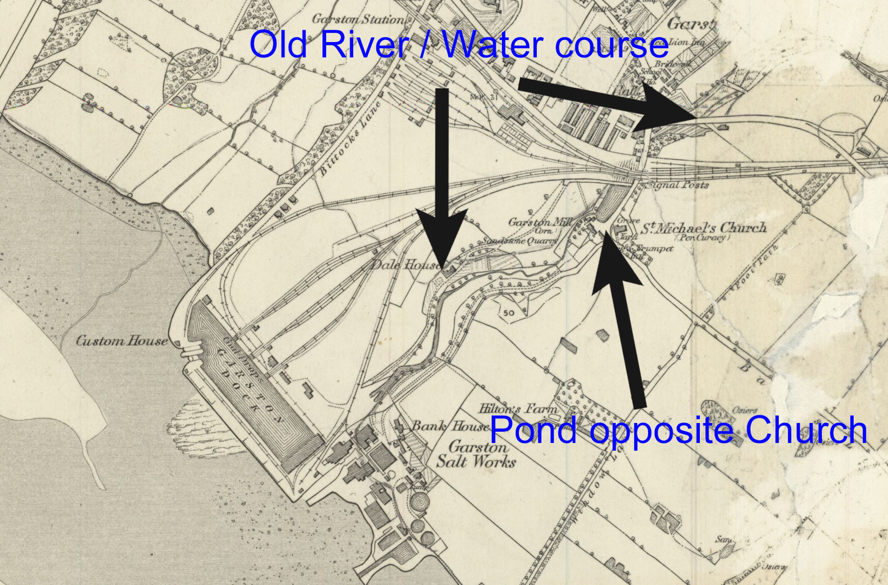
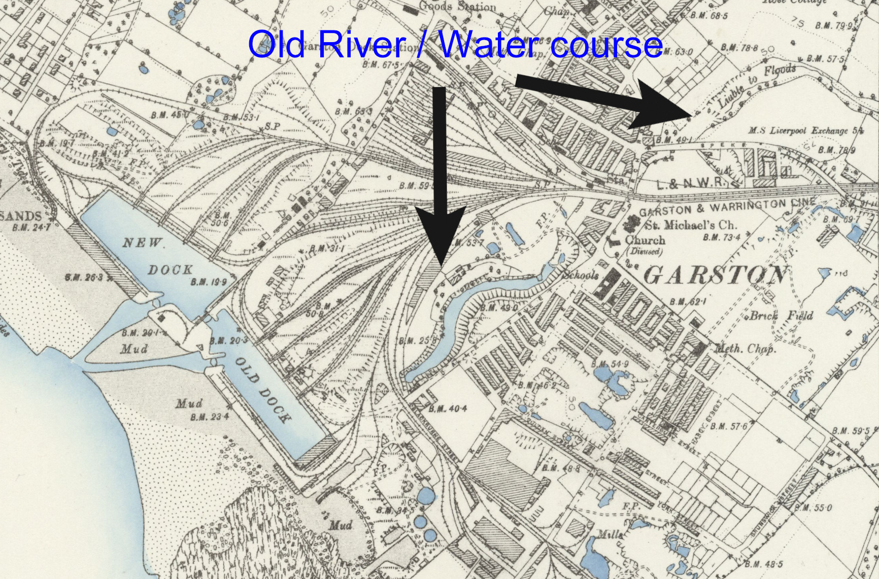
Sections from two old maps of Garston, showing the course of the old Garston Brook. The first of the maps, on the Left : Lancashire Sheet CXIII Surveyed: 1846 to 1864 & Published: 1850 and a slightly later map on the Right: Lancashire Sheet CXIII.SE Surveyed: 1888 to 1891 & Published: 1894 both maps show the original River, with features along it’s length. Followed by the changes that occurred to the brook and it’s visibility as the years passed. Reproduced with the permission of the National Library of Scotland.


Old culvert, believed to be originally built for the ancient Garston Brook, exposed in the 1980’s, during the construction of the New Garston Bypass.
Random Image Galleries
Random Galleries, updated on each page refresh.


Leave a comment