

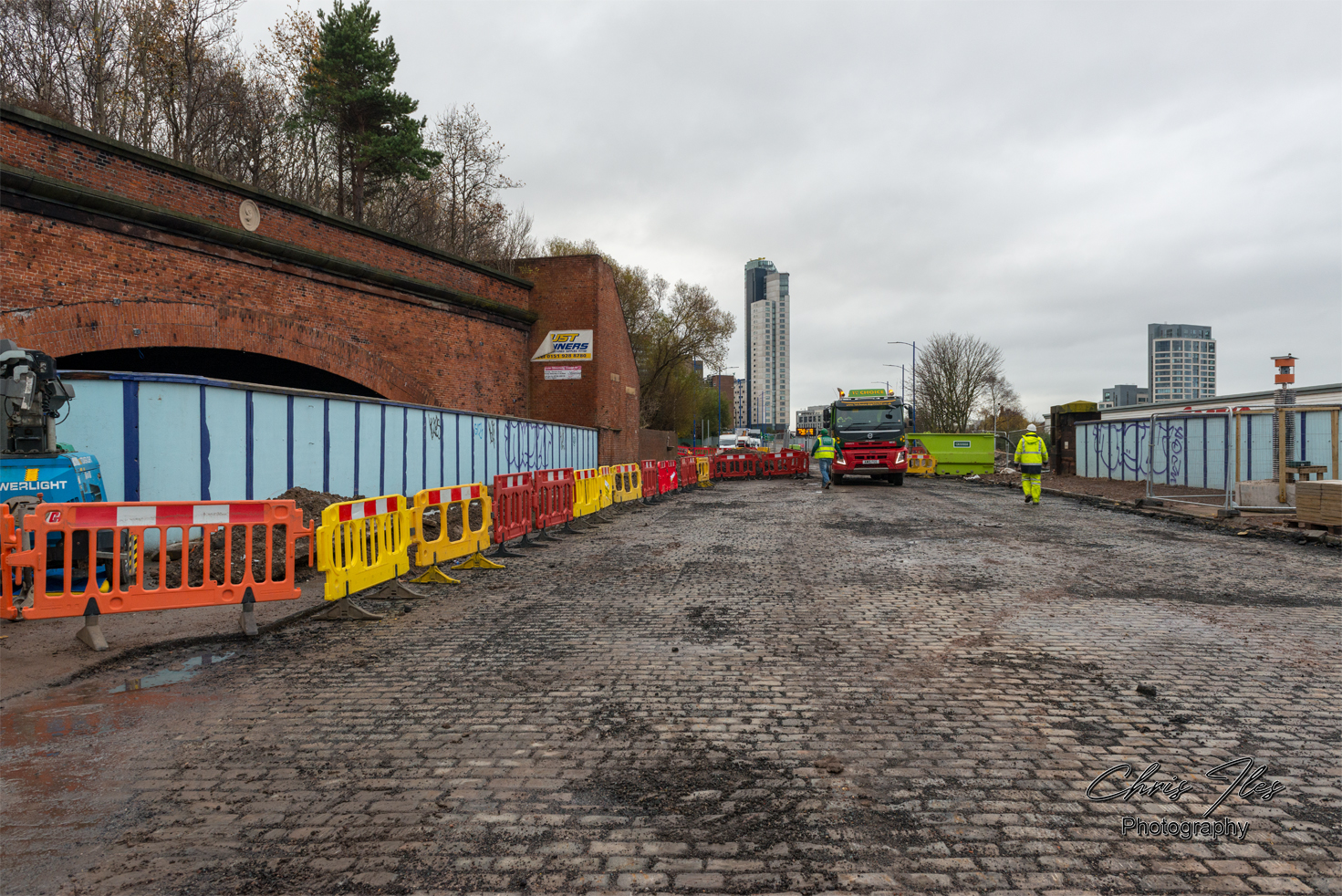
Once a train had passed over the Waterloo branch line, via the Victoria and Waterloo Tunnels, enroute to the former Riverside Station, trains would pass beneath the Grand Arch and Great Howard Street Bridge.
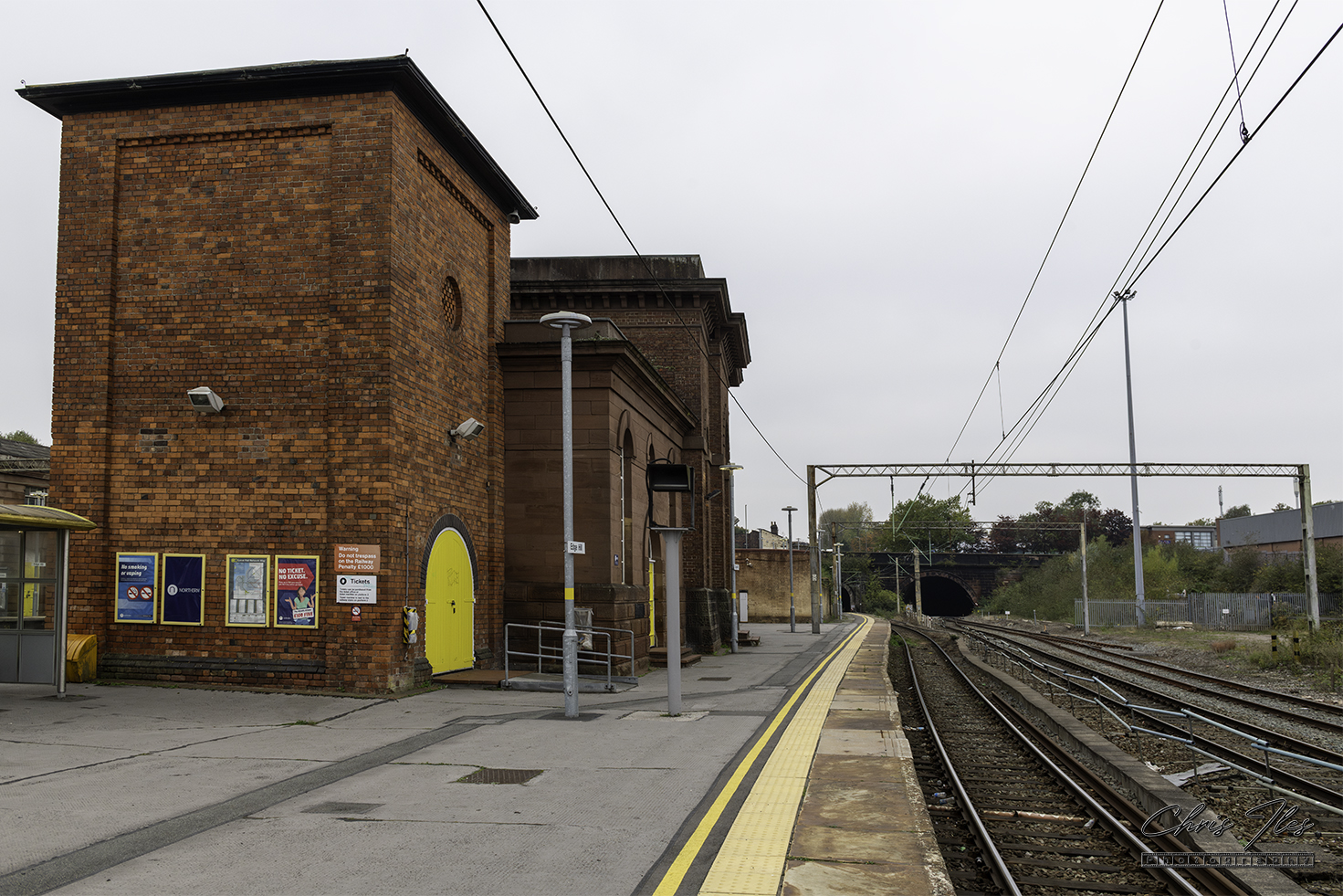
A view from the Historic Edge Hill Station, showing the former Waterloo Branch Line on the right. The Waterloo Branch (now a sidings), provided a route to Riverside Station.
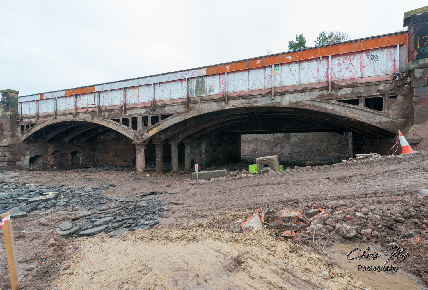
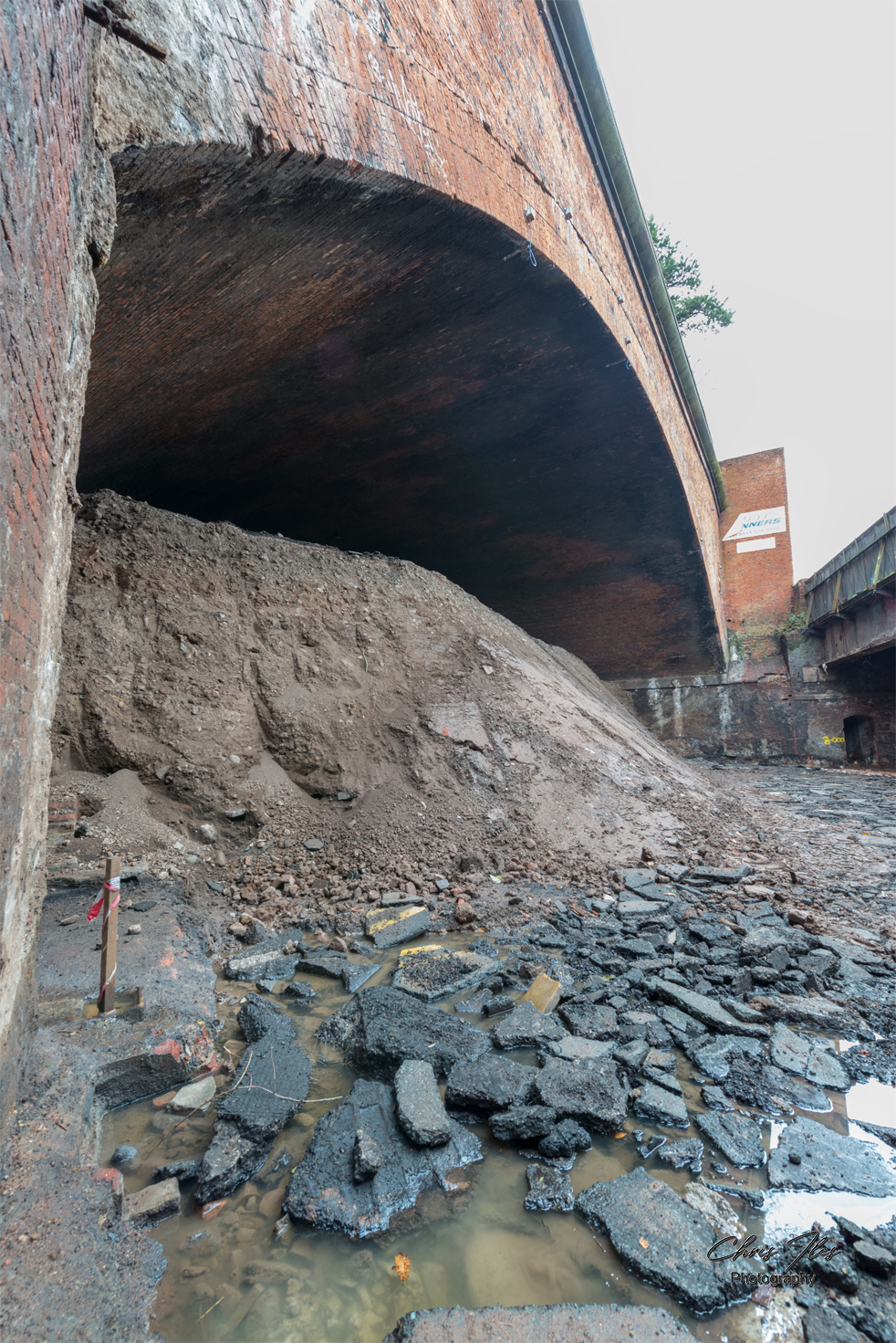
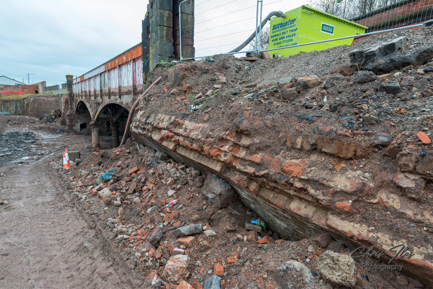
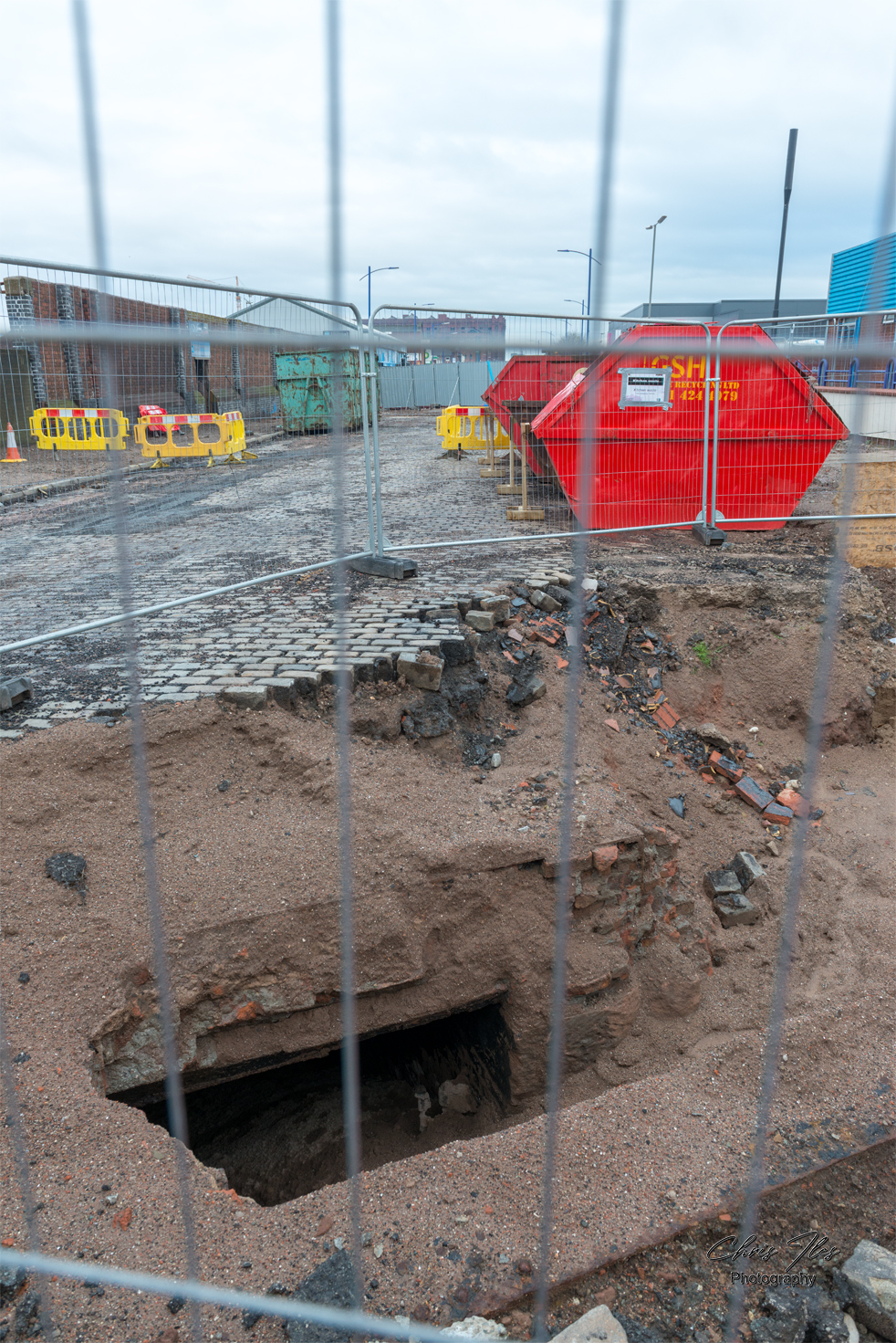
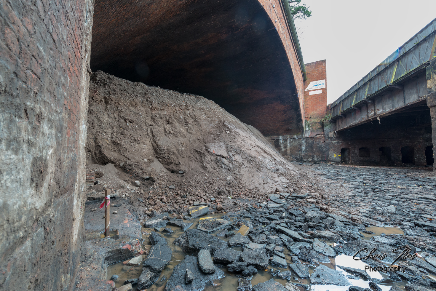
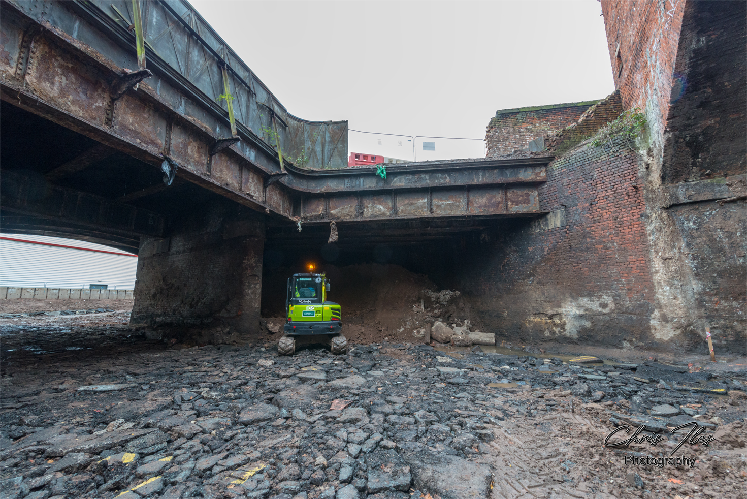
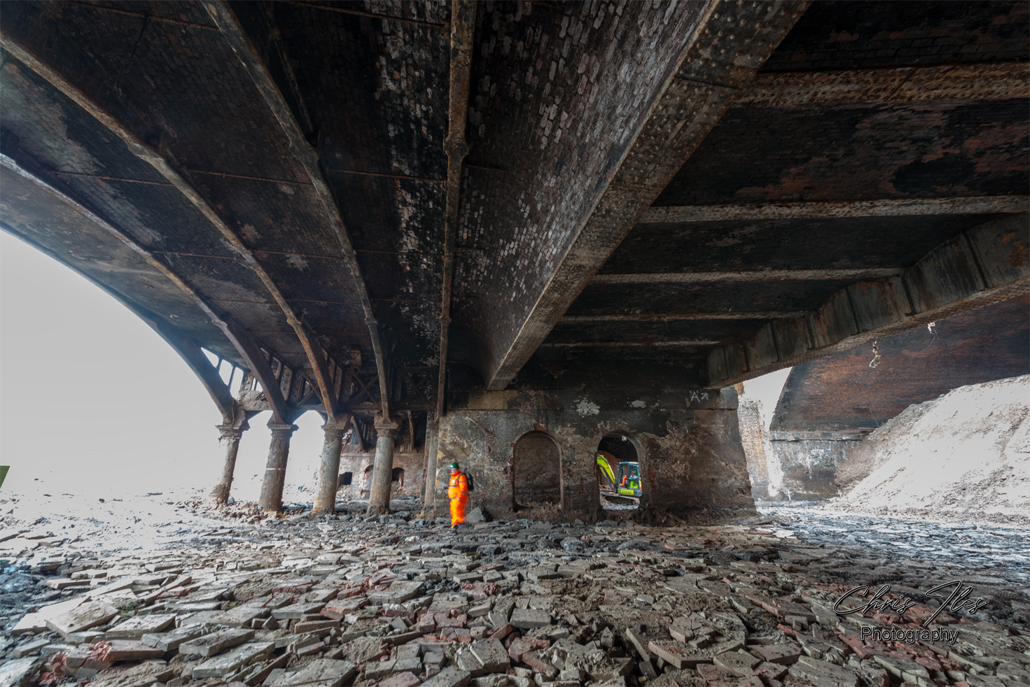
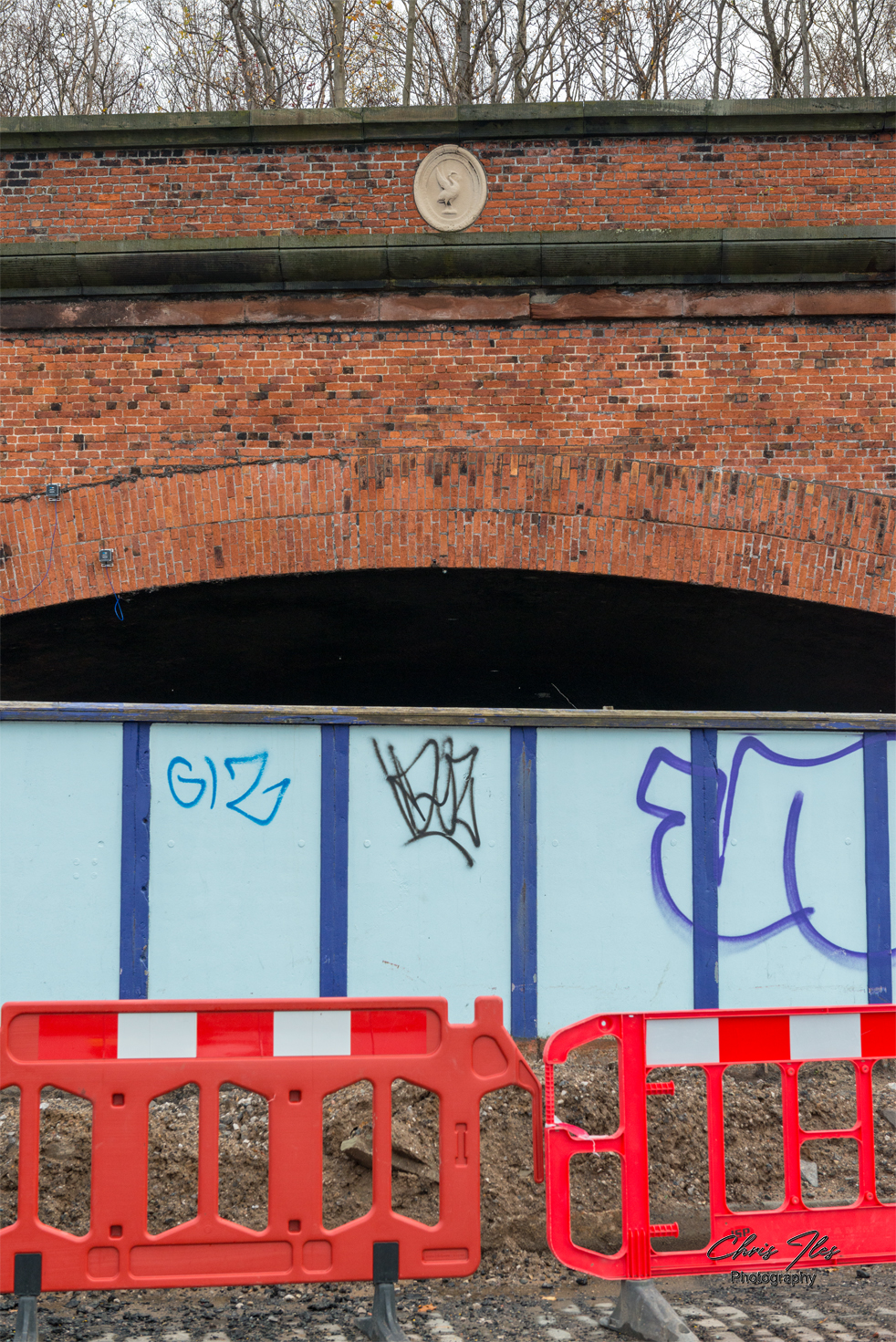
I was given site access to photograph the original metal structure of the Great Howard Street road Bridge (A565), given that the bridge’s structure had been revealed, after being buried for safety reasons for many years. However, this work to reveal the structure of the bridge was sadly in preparation for it’s demolition. The original bridge was constructed by Robert Daglish and Co of St Helens, having a total span of 166ft and being formed of 4 ribs, supported centrally by cast iron columns. The iron bridge was later widened with a steel girder bridge section, which allowed the road to be widened. The original bridge has now sadly been demolished and replaced by a new concrete bridge.
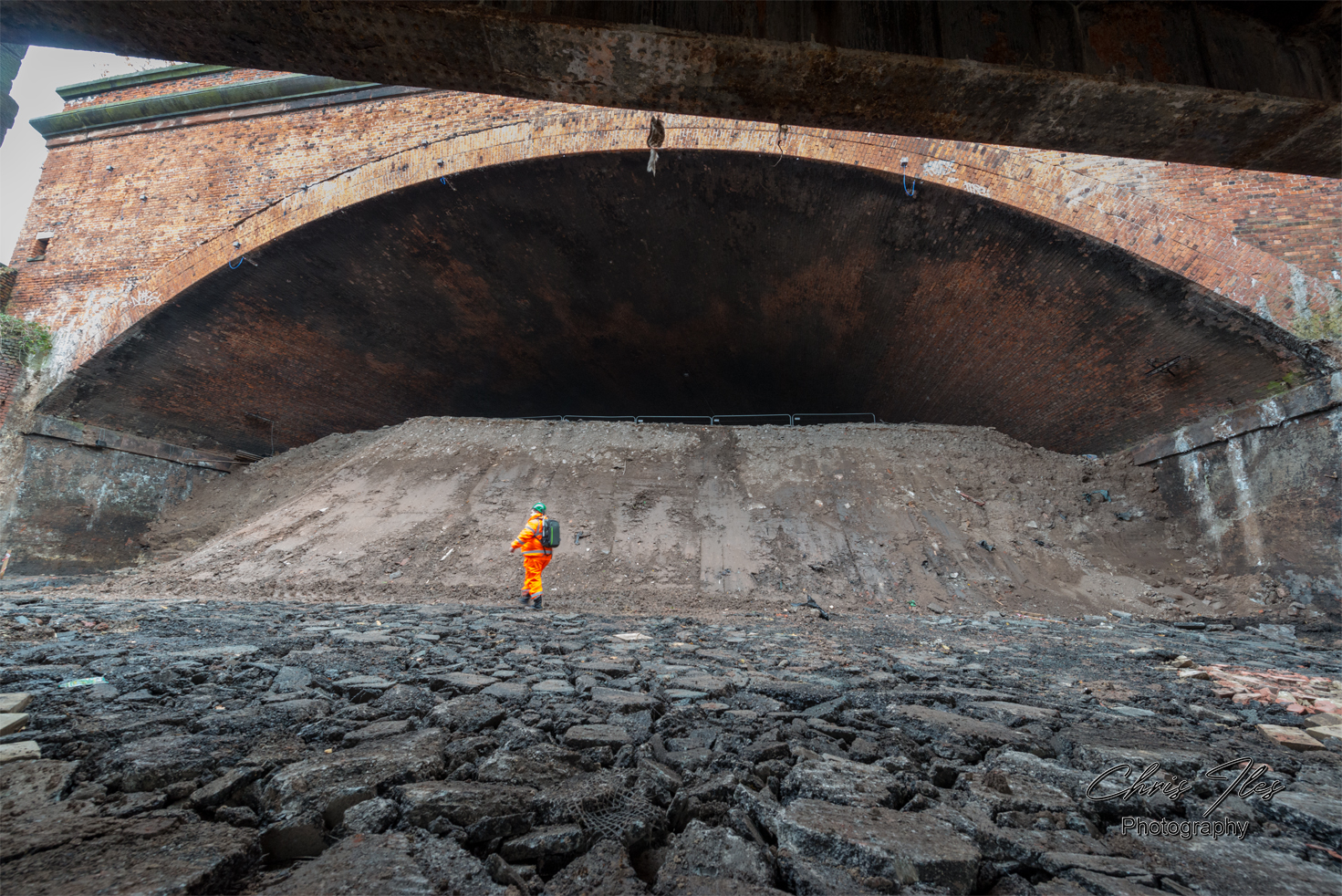
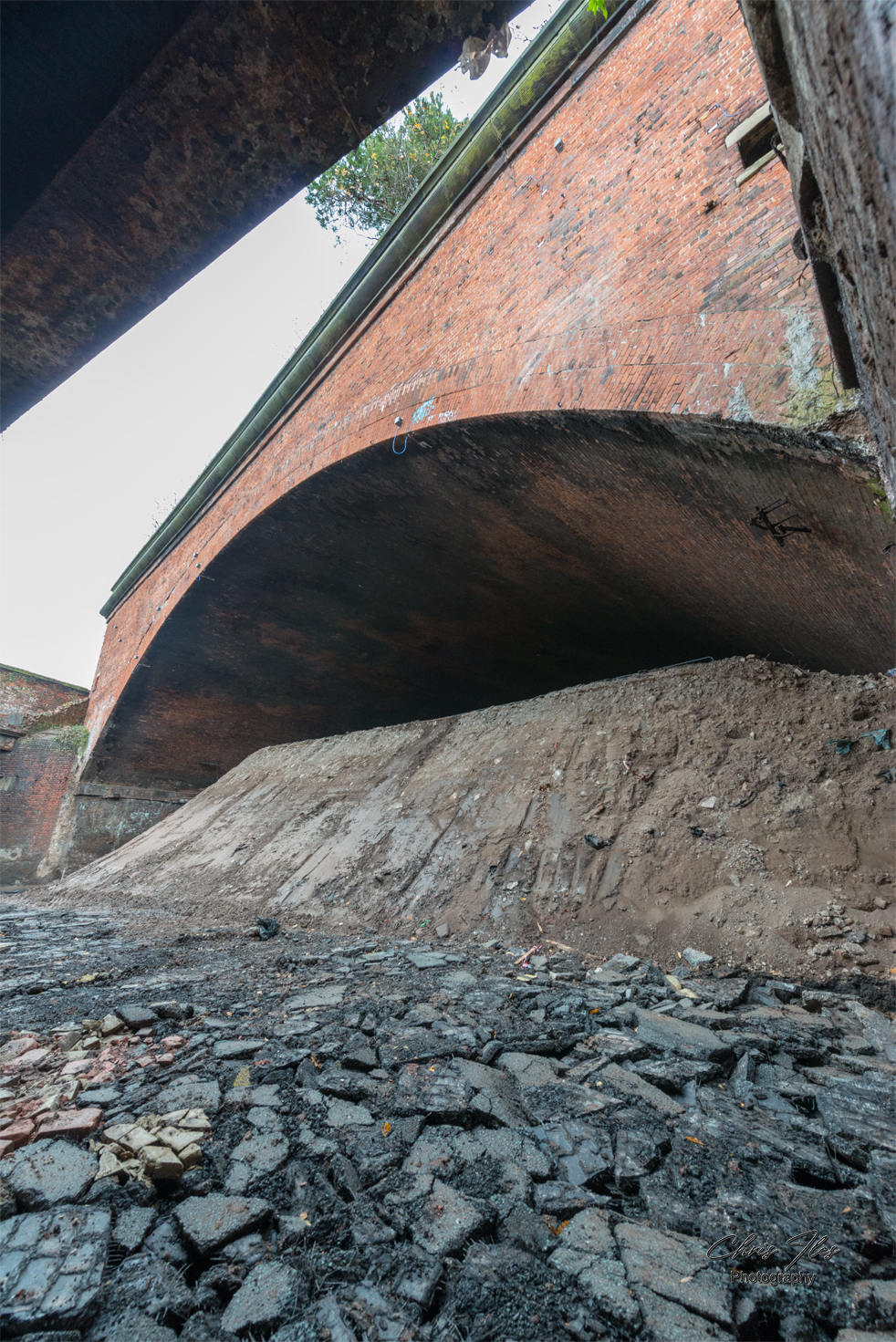
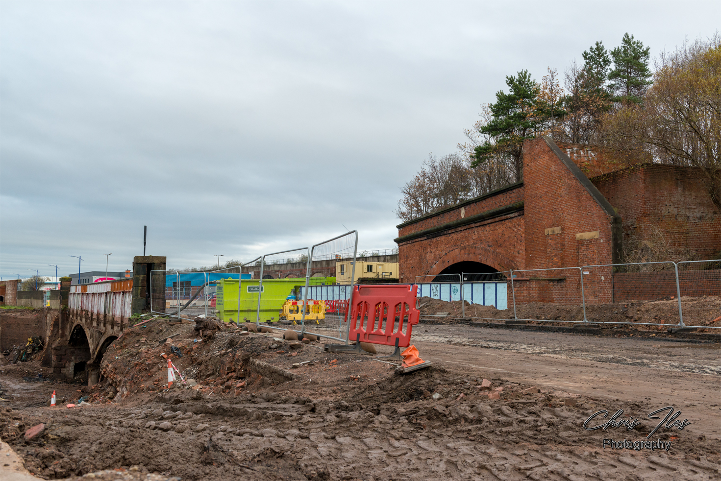
Alongside the Great Howard Street bridge is the impressive ‘Grand Arch’, designed by engineer, John McCormick and built by McCormick and Holmes in 1849. The Massive Grand Arch has a span of 150ft and is wedge shaped in construction, being 135ft on the north side and 200ft on the south side. It was also said that around five and a half million bricks were used in it’s construction. The track bed within the Grand Arch had been backfilled, following the closure of the railway on the 19th November 1972.


Map showing the route of the Waterloo & Victoria Tunnel’s leading to the Grand Arch and Riverside Station.
Open maps to view in greater detail.
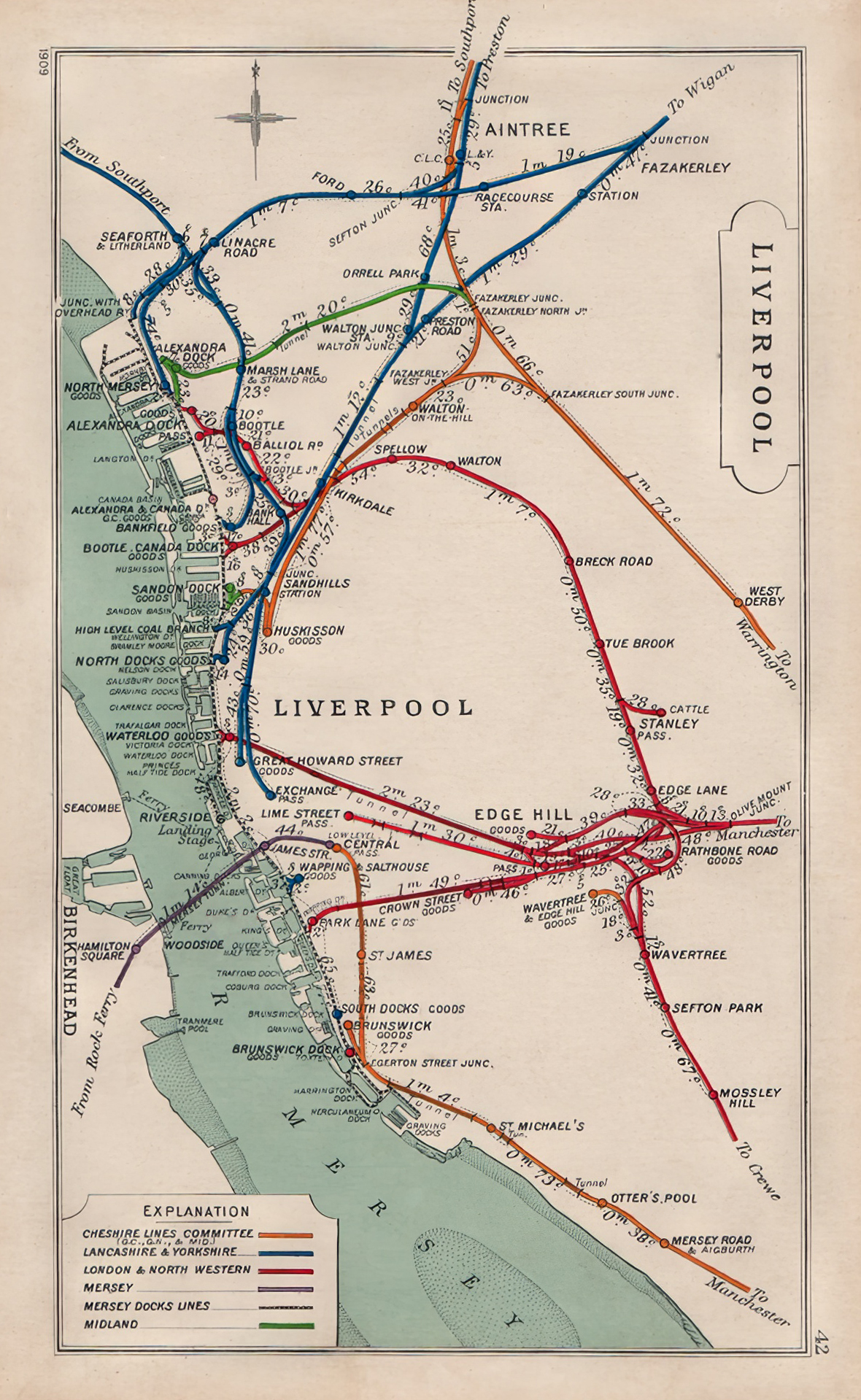

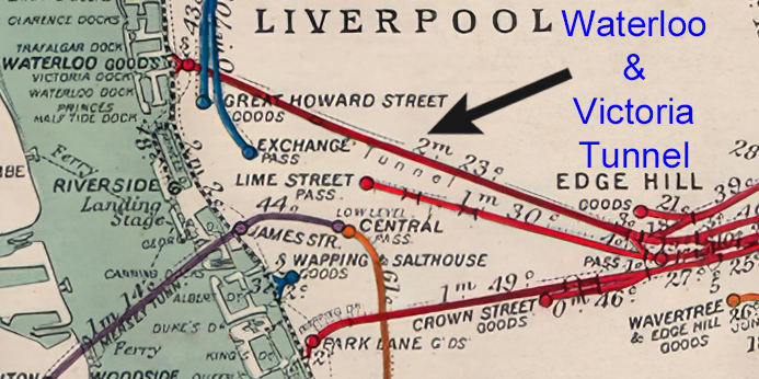

A ‘Railway Clearing House map’, dated 1909, shows the Old Railways of Liverpool with a closeup of the section detailing the long disused, Waterloo and Victoria Tunnel’s leading to Great Howard Street Goods and Waterloo Goods Yard.
A Closeup map of Showing the Railways that cross the Waterloo Branch line, over the Grand Arch and the Great Howard Street Bridge. The Map: OS 1:1,250/1:2500, 1944-1974 Map (curtesy of National Library of Scotland).
The second, is a map I purchased for my collection of Historic Liverpool maps. A ‘Kelly’s Directories’, ‘Map of Liverpool, Bootle and Suburbs 1903’, shows the Railways and stations throughout Liverpool at this time.
Click the maps, to view in more detail.
Random Image Galleries
Random Galleries, updated on each page refresh.


Leave a comment